Sinking Creek Ranch Book Now
Canoes on the Current River under a bluff, or the pasture at golden hour

Things To Do

Stay here. Go see the Ozarks.

Twenty-six rivers, parks, caves and towns inside two hours. Then come back to your own fire on 277 acres.

Mark Twain National Forest picks up on three sides of us

26 placesAll within two hours
Three riversCurrent, Black, Jack's Fork
7+ milesTrail straight from your site
Bortle Class 2About as dark as it gets

Before You Go Anywhere

There's plenty right here.

All 277 acres are open to you while you're staying, at no extra charge.

Clear water over gravel in the creek on the property
The creekSpring fed and clear, and most days shallow enough to wade. It rises fast after rain. Nets and buckets live at the bathhouse.
Riders on the single track through the timber
The trailsSingle track and a 4.5 mile loop through the timber. Ride out of camp and into the national forest without loading up.
The Milky Way over the ranch
The skyNo town glow in any direction. The Milky Way shows up as soon as your eyes adjust.
Pasture, the lone tree, and the timber ridge behind
The landPasture, timber, ridge line, and three horses. Wildflowers turn over from spring into fall.

Trail Map · Free

Our trails on your phone, before you lose signal.

We put the ranch's routes on a shared onX map. It's free, and if we change a route, your copy updates.

Cell service out here is thin. Take five minutes at home or on wifi and the map works on the ranch with no bars.
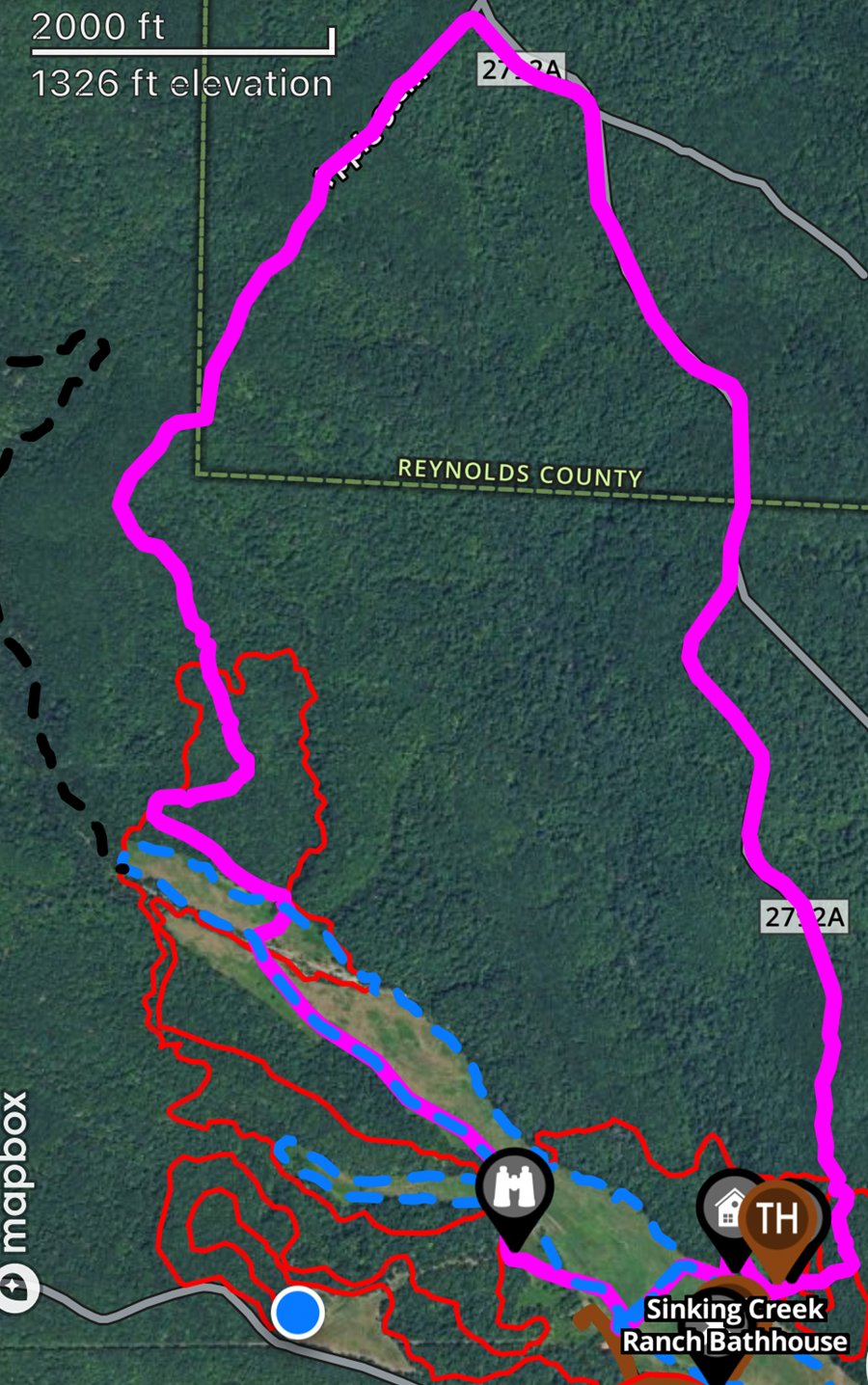
Sinking Creek Ranch routes in the onX Offroad app, drawn over satellite imagery, with the bathhouse and trailhead marked
  • Dirt bike single track
  • Side by side trails
  • Pasture path, 3.5 miles. Walk all of it or any piece, or ride it slow
Tap any route in the app for its type, distance and elevation.
  1. Get the app.Install onX Offroad and make a free account.App StoreGoogle Play
  2. Open our map.Tap the button and accept the invite. It comes from Gabriel Monroy, one of the owners.Open the trail map
  3. Save it offline.In the app, zoom to the ranch and save it as an offline map. The free plan includes one.

On a computer? Accept the invite there, then sign in to the same account in the app on your phone. The map shows where routes run. It does not tell you a route is passable or safe on a given day, and any boundary on it is approximate.

Worth the Drive

Twenty-six places, all inside two hours.

Rivers, shut-ins, caves, a flooded lead mine, and the best trout water in the state. Park the rig once and go see the Ozarks. Drive times, where we list them, are from our gate.

On the water 10

Floating the Current, Black, and Jack’s Fork is the local pastime. Ask us and we’ll point you at the right outfitter for the water that week.

Trails and parks 8
Caves and history 4
Towns worth a stop 4

Where To Eat

Six places we actually send people. Bunker is the closest town to the gate, Salem is where you will end up for the grocery run.

Bunker

  • La FeyitaMexican on Main Street, and the closest sit-down meal to the gate.

Salem

  • JB Malone’s Bar & GrillBurgers, steaks, and live music Friday and Saturday nights.
  • Burnt Offerings BBQBrisket and burnt ends off the smoker. Closed weekends, so catch it on the way in.
  • The Local on 4thWings, tacos, and a patio. Dogs welcome.

Eminence

  • The Dairy ShackBurgers, curly fries, and ice cream out the same window since 1968.

Echo Bluff

  • Creekside GrillInside the lodge with the bluff out the window. Breakfast through dinner.
Fire going, tent glowing behind, full dark

Stay a few days. You still won’t see it all.

Tents, RV sites, and primitive camping, all on the same 277 acres